
Find San Luis Obispo Street Residents
The useful unit in a San Luis Obispo street directory is not the typed street name. It is the parcel that the street points toward. Begin with a complete or partial address, but keep the original spelling and any older form. Use the County Assessor Property Information Search to locate the situs and copy the APN. Open that APN in County LandUseView, check the parcel shape and jurisdiction, then move to the recorder's name index. A name found in a deed is tied to an instrument and date. It is not, by itself, proof of current occupancy.
The path below keeps each record's role distinct. It also gives a fallback when an online page shows only a summary or when the address is older than the web interface.
- Enter the street number and street name in the county property search. Save the APN, legal description, parcel map reference, and any displayed situs or mailing field.
- Open the same APN in County LandUseView. Turn on parcel and land-use layers, click the target polygon, and pan to the parcels that share a boundary or face the street.
- Use the APN and current owner clue to search the Clerk-Recorder index by grantor, grantee, date band, or document number. Read the legal description before accepting a match.
- Search InfoSLO by address or APN for permits, plans, inspections, and code cases. An applicant, owner, contractor, and occupant can be different people.
- For earlier occupants, read a reverse directory by house number, pair the address with census and newspaper evidence, and record the years that produced no hit.
San Luis Obispo Property Fields
The public property route in the San Luis Obispo street directory is built around APN and situs searches. The county portal advertises public APN and address inquiry, while owner-name and DBA modes require authenticated assigned access. That means the public path is normally address to parcel, not name to every parcel. The result can show assessment, fee assessment, parcel size, tax information, characteristics, structures, and improvement values. Authorized views can add current owners, prior owners, document numbers, and valuation history.
A situs address names the physical parcel. A mailing address tells the assessor where notices go. If those differ, the difference may reflect a trust, manager, absentee owner, or preferred mailing destination. Matching them is suggestive, not proof that the owner lives there. The county map can also display a parcel outline without displaying any household member.
| Assessor field | Entry type | Public status | Use in a street search |
|---|---|---|---|
| Search by APN | Full or partial numeric text | Public | Find the exact parcel account |
| Search by Situs | Street number and name text | Public | Turn a street clue into an APN |
| Search by Owner Name | Full or partial name | Authenticated only | Assigned-access ownership inquiry |
| Search by DBA Name | Business name text | Authenticated only | Business-name parcel inquiry |
| Directory Browse | Map-book browse | Public | Use the first three APN digits to find map PDFs |
- Parcel
- A mapped tract tracked by an assessor parcel number.
- Situs
- The physical location of land or a structure, unlike a mailing destination.
- Plat
- A recorded map that lays out lots, lines, or streets for a tract or subdivision.
- Criss-cross directory
- A street-order section that lets a reader move from house number to an occupant or business entry.
The San Luis Obispo property inquiry portal is the captured address-to-APN route.
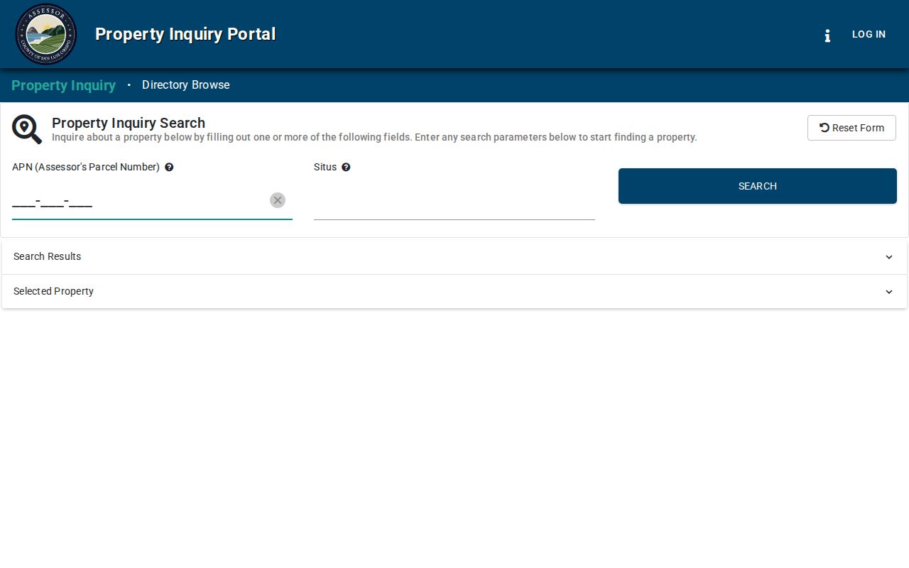
The portal view makes the key limit plain: a public address search can identify a parcel without publishing a complete resident list.
Walking San Luis Obispo Parcels
County LandUseView is most useful when a street search becomes a block search. Search the address or APN, zoom to the parcel, enable parcel and land-use layers, and click the polygon to open its attributes. Pan along the street rather than assuming that a radius or buffer tool exists. Layers can include zoning, city limits, supervisorial or special districts, flood or hazard areas, and aerial imagery. These are mapped boundaries and planning clues, not a household roll.
Record the target APN first. Then note each shared-boundary parcel and each parcel across the street, keeping the exact situs string shown by the map. At a city or county edge, the GIS jurisdiction layer matters more than the postal city. A single street can carry parcels with different government routes, and a San Luis Obispo mailing city can extend beyond incorporated limits.
The San Luis Obispo County GIS hub is the source for the mapping route. A map click identifies land; the assessor and recorder supply the record trail tied to that land.
San Luis Obispo Records by Street
A street directory search should name the keeper and the type of evidence before it names a person. The assessment roll describes parcels. GIS supplies geometry. The recorder index supplies parties to instruments. City permits show project events and named participants. Voter data is controlled by purpose. A reverse directory supplies an intermittent historical occupant view. Chaining those sets through APN, legal description, date, and house number is stronger than treating one search result as a resident list.
| Address record set | Keeper | What it can show | Access path |
|---|---|---|---|
| Assessment roll | County Assessor | APN, situs, values, characteristics, available ownership fields | Web or counter |
| Parcel map and layers | County GIS | Boundaries, frontage, nearby parcels, jurisdiction | Free map browse |
| Deed and lien index | Clerk-Recorder | Parties, transfer instrument, date, document number | Free index; image route |
| Permit and planning file | City of San Luis Obispo | Project chronology and named applicants or professionals | InfoSLO, archive, or CPRA |
| Reverse directory | Library or History Center | Historical occupant or business by house number | Collection access |
| Voter data | Registrar of Voters | Qualified registered voter information | Written application and permitted use |
These are not six versions of the same San Luis Obispo street directory. They are six views with separate custodians. Keep the source label in your notes, and write down the search date because portals, access rules, and record coverage change.
Deeds Along San Luis Obispo Streets
The recorder's index has no simple address search in the captured field set. Begin with the APN and current deed clue from the property record, then search the indexed party name as grantor or grantee. The online index reaches 1923 to the present, while the office states that records reach 1850. Document images downloadable through the self-service path begin August 8, 2001. Earlier images, certified copies, and certain older documents need a kiosk, counter, mail, email, or fax route.
The index can show recording date, document number, book and page for older citations, document type, and party role. It is a finding aid, not the legal text. The legal description in the image is the bridge when a street name has changed or a lot has been split. Search a seller as the earlier grantee, confirm the same parcel or predecessor, and repeat backward.
The county recorded-document search guidance is the source captured for the index rules.
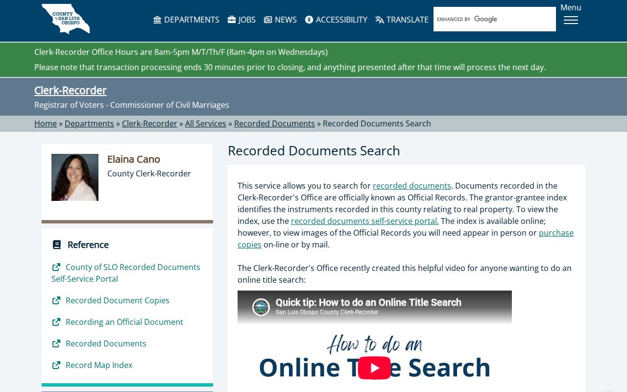
Use the search screen to locate an instrument, then obtain the image when the legal description or party role needs proof.
- Search grantor, grantee, or all indexed names.
- Limit by recording date or document type.
- Use document number or map book and page for a known citation.
- Order or inspect the image when the index does not answer the land question.
San Luis Obispo Permit Trails
InfoSLO adds a city-level address trail that the county parcel roll cannot provide. Enter a partial or complete address and use the magnifying glass, or choose Parcel and enter the APN. The portal can associate a parcel with permits, plans, inspections, and code cases. A project name may point to an applicant, contractor, architect, or owner at a date. It does not establish who sleeps at the address.
Search the current street spelling and any older spelling that appears in a deed, map, newspaper, or directory. The portal can filter or pin results and supports 10, 25, 50, or 100 rows. If the summary names no applicant, ask for the underlying application or use a focused city public-record request. Printed residential or commercial building plans require a Copies of Plans Affidavit and owner or designer authorization because of copyright, while in-person viewing does not require those release forms.
The InfoSLO permit and parcel system is the source captured for this address method. A paid Land Use Documentation Request is different from a CPRA request because staff compiles zoning, entitlements, exceptions, conditions, and code violations into a response.
Reading San Luis Obispo Reverse Directories
The historical part of a San Luis Obispo street directory often runs in the opposite direction from a name index. A criss-cross or street section starts with the house number and street, then points to an occupant or business entry for that edition year. Polk's catalog descriptions include an alphabetical directory, abbreviation guide, street directory, numerical telephone directory, classified business directory, and buyers' guide. The exact abbreviation page should be checked before interpreting an entry.
A 1973 format example reads like a surname, given name or initial, spouse in parentheses, status, an “h” home marker, and street address. A later volume can change spelling or show a mobile-home-space address. Those differences are evidence to compare, not errors to smooth away. The full collection locations and year runs belong with the San Luis Obispo directory book page.
For a street-level past-household question, copy the exact edition, page, spelling, address, and mark. Then compare the next available volume, census year, newspaper, and deed trail. A blank may mean a move, omission, a gap in publication, or an address change.
Address Changes in San Luis Obispo
Street text is not the most durable key in a long San Luis Obispo street directory search. An address, APN, and legal description can change after a subdivision, lot merger, annexation, or renumbering. The safest bridge is the deed's legal description paired with assessor transfer history, subdivision maps, and city engineering or ordinance records. Keep both the old and new street forms in the search notes.
San Luis Obispo also has distinct record eras. The city has more than 4,000 historic building permits from 1906 through 1937, but the collection is incomplete and its annual indexes cover 1923 and 1928 through 1937. Sanborn maps offer free color editions for 1886, 1888, 1891, 1903, 1905, and 1909, with subscription coverage through 1950. Maps show building footprint, material, and use, not occupant identity.
When a former street name produces no result, switch to block and lot, cross streets, inhabitant or owner names, and the parcel's legal description. Negative evidence should include the years and source sets checked.
The recorded-document copy route is the source captured for older image and certification requests.
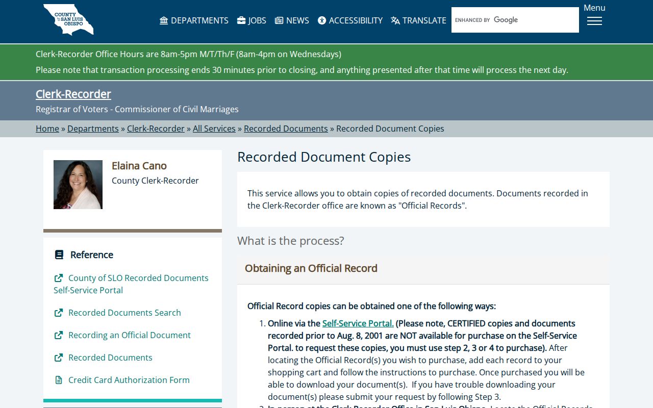
The copy route is the practical bridge when a street record predates the online image purchase path.
San Luis Obispo Voter Limits
The voter roll is tempting because it can contain a name and residence, but California treats it as a regulated data set. The County Voter Status Lookup is personal verification. A file request requires a written application, a permitted election, scholarly, journalistic, political, or governmental purpose, and the required certification. Commercial use is prohibited, and confidential voters or restricted fields are withheld.
Participation history can show whether a ballot was credited in an election, never how a person voted. The file can carry registration status, party preference, precinct, district, and registration date. It is not a public street browser. For a lawful street directory task, use assessor, GIS, recorder, permit, and historical sources first, then ask the Registrar what a qualified request can provide.
San Luis Obispo Street Directory Limits
A San Luis Obispo street directory can show parcels, owners, recorded parties, public project participants, and some historical occupants. It cannot show every household member, every person present at a property, or a guaranteed current resident. Voter data excludes people who are not registered and protected voters. DMV address information is closed by the Driver's Privacy Protection Act. Utility-customer and account records carry strong privacy and security limits.
Lawful personal use. Address records are useful for house history, family research, reconnecting, civic curiosity, and personal safety awareness. Using a San Luis Obispo address trail to stalk, harass, intimidate, or harm anyone is prohibited and may be criminal.
If the goal changes from a whole street to one person, a name-based record question needs its own identity checks. If the goal is the past of one house, compare the deed chain with directories, census schedules, permits, maps, and obituaries rather than treating a current owner as every past occupant.